How do you create a map showing every road in the United States, with the precise location of every stop sign, all the lane markings, every exit ramp and every traffic light — and update it in real time as traffic is rerouted around construction and accidents?
That’s a challenge that automakers and technology companies are confronting in their race to develop self-driving cars, the kind that someday will let you sit back and read or watch TV on the way to work each morning.
The need for highly detailed, three-dimensional, computerized maps — which pinpoint a car’s location and understand its surroundings — is often overlooked amid all the hype about autonomous vehicles.
The chatter tends to focus more on the various sensors that enable cars to “see” the road and any obstacles in front of them. Those sensors include radar, cameras and a laser-based kind of radar known as lidar.
But digital maps are an equally critical piece of the puzzle.
“If we want to have autonomous cars everywhere, we have to have digital maps everywhere,” said Amnon Shashua, chief technology officer at Mobileye, an Israeli company that makes advanced vision systems for automobiles.
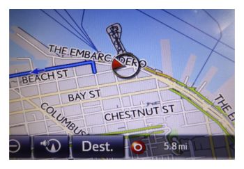
Creating them, however, is a monumental task. There are more than four million miles of roads in the United States. And compared with the maps used by GPS and navigation systems, the level of precision must be much greater. Navigational maps typically locate a car’s position within several yards. Digital maps for autonomous cars must know the locations of cars, curbs and other objects within about four inches.
So far the drive to create digital maps has been slow. Google’s former self-driving car division — now a company called Waymo — has created maps for roads around its headquarters in Mountain View, Calif., and a handful of other cities, including Austin, Tex., and Kirkland, Wash.
Waymo creates the maps by driving around cars equipped with spinning lidar units mounted on their roofs that shoot out laser beams, creating images of the road and the surroundings. Human engineers, in a time-consuming process, then go over the images and tag the objects that are found, like stop signs, buildings, stoplights and do-not-enter signs. The laser equipment needed to do this scanning is expensive — it can cost $100,000 or more to outfit just one car to do this job.
Another company, Here, which was started by Nokia and then acquired by the German automakers BMW, Daimler and Audi, is also mapping roads in the United States and Europe. It is drawing on data scooped up by scanning systems that trucking companies have agreed to install on their vehicles. Here also has its own fleet of cars collecting images, and is working on algorithms to enable computers to annotate the maps.
The effort may soon shift into higher gear, thanks to an idea borrowed from the internet that has helped in other fields: crowdsourcing.
Read more of the original article at The New York Times.